Precision Drone Mapping for Irrigation | Improve Farm Water Decisions
- Parivash Sarani
- Dec 29, 2025
- 4 min read

Introduction
Water is essential for agricultural productivity, yet inefficient irrigation decisions can waste resources, stress crops, and reduce yield. Traditional irrigation planning often relies on fixed schedules, soil probes, and visual scouting — methods that may miss localized water stress or uneven soil moisture. In contrast, precision drone mapping for irrigation provides farmers with high-resolution aerial data to understand spatial variation in moisture, crop water stress, and field topography. With this data, growers can move from reactive watering to data-driven irrigation decisions, ensuring plants receive the appropriate water at the right time.
What Is Precision Drone Mapping for Irrigation?
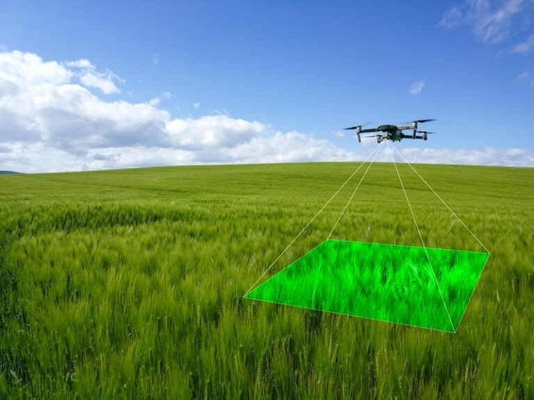
Precision drone mapping for irrigation refers to the use of unmanned aerial vehicles (UAVs) equipped with advanced sensors — including thermal, multispectral, and RGB cameras — to collect detailed imagery of fields. These images are processed into maps that reveal soil moisture patterns, water stress areas, and drainage issues across the farm.
How Drone Sensors Detect Water Stress
Thermal sensors measure temperature variations in crops and soil — stressed or under-watered zones typically show warmer surface temperatures.
Multispectral imagery identifies variations in plant health that correlate with water availability.
High-resolution orthomosaic maps allow identification of micro-zones requiring differential irrigation.
Each technology contributes unique insights, enabling farmers to see beyond what’s visible at ground level and make timely irrigation adjustments.

Key Benefits for Irrigation Decisions
Precision drone mapping directly addresses common irrigation challenges through several practical advantages:
Early Detection of Water Stress
Drones can detect water stress before visible symptoms appear. Thermal and multispectral maps highlight crop zones that are under-hydrated or over-hydrated, allowing corrective irrigation before yield is compromised.
Optimized Water Use and Conservation
Drone mapping helps identify:
Over-watered areas that waste water
Under-watered zones that need targeted irrigation
Drainage problems that cause waterlogging
By applying water only where needed, farmers reduce waste and conserve a critical resource. Detailed field analysis using aerial data has been shown to reduce water usage by 20–35% compared to traditional irrigation approaches.
Better Irrigation Planning and Schedule Adjustment
Rather than following fixed irrigation schedules, farmers can plan variable irrigation tailored to crop needs, soil variation, and field topography. This precision planning helps maximize water efficiency and supports plant growth when it matters most.
How Precision Drone Mapping Works in Practice
Step 1 — Aerial Data Collection
Drones fly predetermined grid patterns over fields to collect overlapping images. Flights are usually conducted in calm weather and consistent lighting to ensure high quality. Sensors capture:
Temperature differentials
Vegetation indices (e.g., NDVI)
Terrain elevation and moisture patterns
These data layers form the foundation for irrigation insights.
Step 2 — Image Processing and Mapping
Collected images are processed into maps using specialized software. These maps can show:
Soil moisture variations
Areas with potential water stress
Irrigation delivery inconsistencies
AI and machine learning tools can further analyze trends and predict irrigation needs over time.
Step 3 — Actionable Decisions
Farmers use processed maps to:
Adjust irrigation timing and volume
Identify malfunctioning irrigation equipment
Plan variable rate irrigation (VRI) systems
By acting on precise data, growers transform water from a limiting factor into a managed resource.
Challenges and Limitations
While the advantages are significant, a few considerations remain:
Initial costs of drone equipment and sensors may be high for some operations.
Training and skills are required to interpret maps and make decisions.
Regulatory considerations vary by region and may require operator certification. AAI-Drones
Despite these challenges, decreasing costs and improved software are making precision drone mapping more accessible to farms of all sizes.
Precision Drone Mapping and Irrigation in Australia
In Australia’s farming landscape, where water scarcity and extreme climate variability are common, precision drone mapping for irrigation plays a crucial role. Farmers in regions like Western Australia, Queensland, and New South Wales face challenges associated with uneven rainfall and high evapotranspiration. By capturing field-wide moisture and stress patterns, drones help:
Conserve water resources critical in arid zones
Plan irrigation schedules based on crop developmental stages
Detect irrigation system inefficiencies such as leaks or uneven sprinkler coverage
These insights support sustainable water use and help Australian growers tackle the distinct challenges of local climates.
Conclusion
Precision drone mapping for irrigation is a transformative tool in modern agriculture. By providing high-resolution aerial data that reveals water stress, soil moisture variability, and irrigation inefficiencies, drones empower farmers to make smarter, data-driven irrigation decisions. This approach:
Detects water stress earlier than visual scouting
Reduces water waste and lowers costs
Improves crop health and productivity
Supports sustainable irrigation practices
For farms in Australia and worldwide, precision drone mapping elevates irrigation from guesswork to precision science, enabling better resource use in an era of increasing environmental and economic pressures.
Sources
Drone mapping enables optimized irrigation planning and analysis of water distribution patterns, reducing waste and identifying drainage issues. Map Library
Drones collect soil condition and moisture data, enhancing irrigation decisions and reducing water consumption by up to ~30%. AAI-Drones
Multispectral and thermal imaging detect crop stress and moisture variability for targeted irrigation. Farmonaut
Drones improve irrigation practices by assessing moisture and tailoring schedules to field needs. Drone Technology EU
Combining drone imagery with AI/IoT can further enhance irrigation accuracy and efficiency. journal.riverpublishers.com


Comments