MINING, ENVIRONMENT
AND GEOLOGY

Blast Control (Pre and Post-Operation Surveys)
-
Service Overview: Using the DJI M350 equipped with MicaSense or LIDAR sensors, we offer comprehensive pre- and post-blast surveys that provide critical data to ensure safe and effective blasting operations in mining sites.
-
Key Benefits
-
Pre-Blast Analysis: Perform topographic surveys to identify geological features, calculate blast designs, and assess risks before executing a blast.
-
Post-Blast Assessment: Capture high-resolution imagery and LIDAR data to analyze the effectiveness of the blast, such as measuring the extent of rock displacement and blast fragmentation.
-
Precision and Accuracy: With LIDAR technology, you get accurate 3D models and measurements that provide insights into the impact of blasting, helping optimize future operations.
-
Improved Safety and Compliance: Ensure all blast operations meet safety standards and environmental regulations.
-
Cost Efficiency: Reduce the need for manual post-blast surveys, saving both time and money.
-

Mine Rehabilitation and Monitoring

-
Service Overview: After mining operations, land rehabilitation is crucial for restoring ecosystems. We provide comprehensive monitoring and restoration services using drones equipped with DJI Agras T50 for seeding and fertilizing, along with NDVI (Normalized Difference Vegetation Index) for precise monitoring of vegetation health. This approach ensures a successful rehabilitation process, promoting sustainable land recovery.
-
Key Benefits
-
Efficient Seeding and Fertilizing: Using the DJI Agras T50, we can perform aerial seeding and fertilizing over large, hard-to-reach areas with high precision. The drone disperses seeds and fertilizer evenly across the terrain, helping to quickly establish vegetation and restore soil health.
-
NDVI Monitoring for Vegetation Health: With NDVI analysis, we can track the health of vegetation across the rehabilitated land, identifying stressed areas that require additional attention. NDVI allows for precise, real-time insights into plant growth, helping to assess the effectiveness of the rehabilitation efforts.
-
High-Precision Data Collection: NDVI imagery is captured using MicaSense multispectral cameras, offering detailed insights into the density, health, and progress of vegetation recovery. This data enables targeted interventions to enhance regrowth.
-
Cost and Time Efficiency: The use of drones significantly reduces the time and cost associated with traditional ground-based monitoring, allowing for faster, more cost-effective assessments.
-
Data-Driven Insights for Optimal Rehabilitation: The combination of seeding, fertilizing, and NDVI monitoring ensures the rehabilitation process is scientifically managed, with data-backed decisions to optimize soil restoration and vegetation growth.
-
Environmental Compliance and Sustainability: Our drone services help ensure your rehabilitation efforts meet environmental regulations and sustainability goals by tracking the land’s recovery over time.
-
Asset Inspection with DJI Avata
-
Service Overview: We provide highly efficient and precise asset inspection services using the DJI Avata drone. Equipped with high-definition cameras and advanced stabilization systems, the Avata offers reliable aerial views for inspecting equipment, structures, and infrastructure in mining and geological operations.
-
Key Benefits
-
High-Resolution Imaging: Capture detailed, high-definition images and videos of assets such as mining equipment, pipelines, and infrastructure.
-
Speed and Efficiency: Reduce inspection time by rapidly covering large areas (up to 10+ hectares per hour), compared to traditional manual inspections.
-
Cost Savings: Minimizing the need for costly manual labor and hazardous onsite inspections.
-
Safety: Inspect hard-to-reach or dangerous areas safely from the air, reducing risks to personnel.
-
Detailed Reporting: Provide detailed imagery and data for maintenance schedules, repairs, and audits.
-

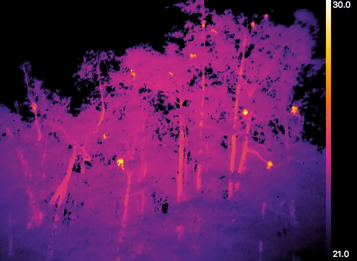
Asset Inspection Using Thermal Camera

-
Service Overview: We provide highly efficient and accurate mining asset inspections using the DJI M350 drone, equipped with a H30T the most robust thermal camera in the market. This service is ideal for inspecting critical mining infrastructure such as machinery, buildings, electrical systems, and pipelines. Thermal imaging allows for the detection of temperature anomalies, which can indicate potential issues like overheating, electrical faults, or mechanical failure.
-
Key Benefits
-
Thermal Imaging for Fault Detection: The thermal camera captures infrared images that help detect temperature variations in equipment, machinery, and infrastructure. Hot spots or overheating components can be quickly identified, preventing costly breakdowns and safety hazards.
-
High-Resolution Thermal Data: The DJI M350 paired with a H30T sensor provides detailed thermal images, offering precise data for maintenance and repairs. This enables early detection of issues like worn-out bearings, electrical malfunctions, or any other heat-related problems.
-
Speed and Efficiency: The M350 drone can cover large areas quickly and safely, inspecting multiple assets in a short amount of time. With thermal imaging, hard-to-reach or high-risk areas can be inspected remotely, eliminating the need for personnel to access potentially dangerous spots.
-
Enhanced Safety: Using thermal cameras for asset inspections ensures the safety of your workers by reducing the need for manual inspections of hazardous or difficult-to-reach locations, such as high-voltage equipment or areas prone to fire hazards.
-
Cost-Effective Maintenance: Traditional asset inspections often require costly human labor and equipment downtime. With drones, you can conduct frequent inspections without interrupting daily operations, leading to cost savings and minimized downtime.
-
Detailed Reporting and Analysis: After each inspection, we provide comprehensive thermal imagery and reports, highlighting areas that require attention. These reports include actionable insights to help you prioritize repairs and maintenance schedules.
-

Environmental Surveys and Wildlife Monitoring

-
Service Overview: Protecting wildlife and preserving natural ecosystems is a vital part of sustainable mining operations. We offer comprehensive Wildlife Monitoring and Environmental Surveys using our advanced fleet of drones, including the DJI M350, equipped with thermal, multispectral, and LIDAR cameras. These services provide precise, real-time data for monitoring environmental conditions, wildlife populations, and habitat health, ensuring that mining activities meet environmental regulations and support biodiversity conservation.
-
Key Benefits
-
Wildlife Monitoring with Thermal Imaging: The DJI M350, equipped with a thermal camera, allows for effective wildlife monitoring, even in low-light or nighttime conditions. Thermal imaging helps track animal movements, monitor wildlife populations, and identify any potential disturbances caused by mining activities.
-
Multispectral Imaging for Habitat Health: Using the MicaSense camera on the DJI M350, we conduct detailed multispectral surveys that assess vegetation health, water quality, and overall habitat conditions. The multispectral data helps detect stress in vegetation, indicating issues such as contamination or ecosystem imbalance.
-
LIDAR for Detailed Environmental Mapping: The LIDAR-equipped drones provide precise topographical maps, helping monitor changes in the landscape, soil erosion, water flow, and other critical environmental factors. LIDAR also captures high-resolution 3D models of habitats, allowing for a better understanding of terrain and vegetation structure.
-
Cost-Effective and Time-Saving Surveys: Traditional wildlife and environmental monitoring can be expensive and time-consuming, especially for large areas. Our drone-based surveys dramatically reduce survey time, enabling frequent monitoring and real-time data collection at a fraction of the cost.
-
Enhanced Safety and Efficiency: Drones eliminate the need for personnel to access remote or hazardous areas, minimizing risk while providing high-quality, actionable data.
-
Environmental Compliance and Reporting: We provide detailed environmental reports with actionable insights, including data on habitat health, wildlife populations, and ecological impacts. This helps ensure compliance with environmental regulations, supports conservation efforts, and allows for proactive decision-making to minimize ecological disturbance.
-
Real-Time Data and Actionable Insights: With our drone services, you receive real-time monitoring data, enabling quick responses to any potential environmental issues or changes in wildlife behavior. This allows for immediate corrective actions to ensure minimal impact on the environment and wildlife.
-
Geological Mapping and Surveying
-
Service Overview: Using the DJI M350 with LIDAR technology, we offer detailed geological mapping services, ideal for mineral exploration, topographic surveys, and assessing geological formations.
-
Key Benefits
-
High-Precision Mapping: LIDAR generates highly accurate 3D models of the landscape, allowing for the identification of mineral deposits, faults, and other geological features with unmatched precision.
-
Rapid Data Collection: Drones can cover vast areas much faster than traditional surveying methods, delivering timely results without compromising on detail.
-
Cost-Effective Exploration: Reduce the costs of ground-based exploration by using drone data to create comprehensive geological maps for exploration planning.
-
Better Planning: Use high-resolution data to identify optimal drilling sites, fault lines, and topographical features for mining operations.
-


Why Choose Our Drone Mining and Geological Services?
-
Advanced Technology: Our fleet of DJI M350, DJI Avata, and LIDAR-equipped drones provide the latest in aerial surveying and mapping technology, delivering high-precision, high-resolution data.
-
Speed and Efficiency: Our drones can cover large areas quickly, saving you valuable time and reducing labor costs compared to traditional methods.
-
Cost Savings: Reduce the need for expensive ground surveys and manual inspections with our affordable and efficient drone services.
-
Safety and Compliance: Minimize risks with safe, non-intrusive inspections and ensure compliance with environmental and safety regulations.
-
Comprehensive Reporting: We provide you with detailed, actionable data in easy-to-read formats, enabling data-driven decision-making for better mining operations.